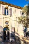
Vallon des Glauges
The Glauges bring you to discover beautiful landscapes, typical of the Alpilles Regional Natural Park. In the heart of the valley, which separates Opies from Mont Menu, the paths will alternate between olive groves and vineyards shaped by humans for many years, and in a Provencal scrubland offering a rich biodiversity.
7 points of interest
 Patrimony and history
Chabaud Arenas
The Chabaud arenas are located on the site of an old mill built in 1787. The main building of this mill still exists inside the bullring. The aqueduct, which is distinguished outside the arena, was intended to supply the mill with water. Around 1898, no longer reporting sufficient income to the town, the mill is sold to an individual. Auguste Chabaud, last owner of the mill, transforms the infrastructures into arenas, inaugurated on August 8th, 1926.
 Water and rivers
Valley des Baux canal
This canal, measuring 53 km long, has been the subject of a long process of reflection and design. Started in 1792, the canal will be put in water a century later, in 1914. To develop human presence and economic activity in the Alpilles, it was important that a hydraulic network irrigate the territory and allow agriculture to develop. This canal alone feeds the southern part of the massif.
 Produits du terroir
The olive tree
Emblematic culture of the territory of the Alpilles, the olive tree is the symbol of the dry Mediterranean climate. Its multiple trunks are the result of a release at the strain level following a significant frost in 1956. Today, some of the olives and oils produced in the Alpilles are recognized nationally and internationally, benefiting from the Protected Designation of Origin (PDO).
 Patrimony and history
Opies view
This relief is characterized by a set of ridges where is the highest point of the territory of the Park: the Opies, at 498 m altitude. From the tower that symbolizes the summit, it is possible to see up to the alpine massifs. This tower was a watchtower, built at the dawn of the twentieth century, to prevent the fire in the massif. It is now used to house the Mistral adventurers who have reached the summit.
 Produits du terroir
Gauges Valley Estate
The Glauges valley estate has a total surface area of ??72 hectares, 45 of which are dedicated to wine production and 4 to olive oil. Their distribution, between valleys, slopes and plateaus, allows to have wines with diversified character. The estate also strives to have a reasoned culture, combining the needs of the vines and the protection of the ecosystem, as evidenced by the 23 hectares of woods and garrigue preserved.
 Panorama
View on the Crau lowland
The Crau lowland forms a triangle with an estimated surface area of 550 km2. It is an arid pastoral lawn, forming a specific vegetation, named "coussoul". The south is called "Dry Crau", a remarkable steppe habitat. Today there are 95 km2;of intact steppe. The northern part of Crau, irrigated from the 16th century. through the Craponne canal and put into cultivation, forms the "Crau humide", where the Crau hay is produced, the first forage to obtain an AOC.
 Geology
Eyguières Coussoul
The coussoul is a steppic pastoral lawn. Its rough vegetation grows on a very fine soil, which covers the pebbles coming from the old bed of the Durance. At less than one meter deep, there is a layer of pebbles cemented by a crust of mineral salts. Called "poudingue", it directly impacts the growth of trees. In Eyguières, there is little coussoul because the lawn has been replaced by crops, but we observe very well pebbles conducive to its development.
Description
Back to the car park, climb to the right, between the Chabaud arena and the cemetery, the marked path of the Col of Melet tagged GR® and PR. Follow this marked path for 1 km, cross the channel of the valley of Baux and join an intersection where is implanted a panel of the Department.
1- fork right on the tarmac path marked PR, following the panel "Eyguières par le vallon des Glauges 7.8 km". Cross again the channel, then at the bend to the left take straight on the path of St-Pierre-de-Vence, marked blue and green. Follow it on 1.5 km.
2- At the end of the road, turn left on the paved road Glauges, marked PR. At the entrance to the domain vallon des Glauges, leave the paved road to climb the path on the right, marked PR, which passes through the vineyards. Join 500 m further an intersection with a DFCI barrier.
3- Pass the barrier to the right and follow this marked path PR. Leave a property on the right, pass a second DFCI barrier and cross the next junction. 300 m further, stay on the left and join a cross a few meters lower.
4- borrow the path to the left, signposted GR®. Continue straight for 1.2 km, leaving aside the different paths encountered, and join the D17 road. (Caution, traffic!) Turn left on this marked GR®, follow it for 300 m and turn left on a tarred road. Find 150 m further the intersection with the panel of the Department and the path of the Col de Melet. Resume this path and return to the starting point.
- Departure : Parking arena Chabaud, Eyguières
- Arrival : Eyguières
- Towns crossed : Eyguières
Forecast
Altimetric profile
Recommandations
For your safety, and for the preservation of forest areas, access to natural areas is regulated from June to September. Inquire during the summer period on 08 11 20 13 13 (price of a local call) or on www.bouches-du-rhone.pref.gouv.fr Download the application for free MYPROVENCE ENVIE DE BALADE (available on Appstore and Android Market).
Information desks
House of the Alpilles Regional Nature Park
2, boulevard Marceau, 13210 Saint-Rémy-de-Provence
Located in the heart of the city centre of Saint-Rémy-de-Provence, the House of the Alpilles Nature Park welcomes you to its completely renovated premises. This new vibrant place is multifunctional: it accommodates the Park's engineering team but also has a public reception space and showrooms. A true resource centre of the Park's heritage, it aims to support and promote locals, visitors and tourists on all 16 municipalities of the Park.
Open Monday to Friday, from 9 am at 12:30 pm and from 1:30 pm to 5 pm.
Free admission.
Service Info Tourisme
Place de l’ancien Hôtel de Ville, 13430 Eyguières
Transport
Access and parking
Parking :
Report a problem or an error
If you have found an error on this page or if you have noticed any problems during your hike, please report them to us here:


