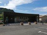
The Devès
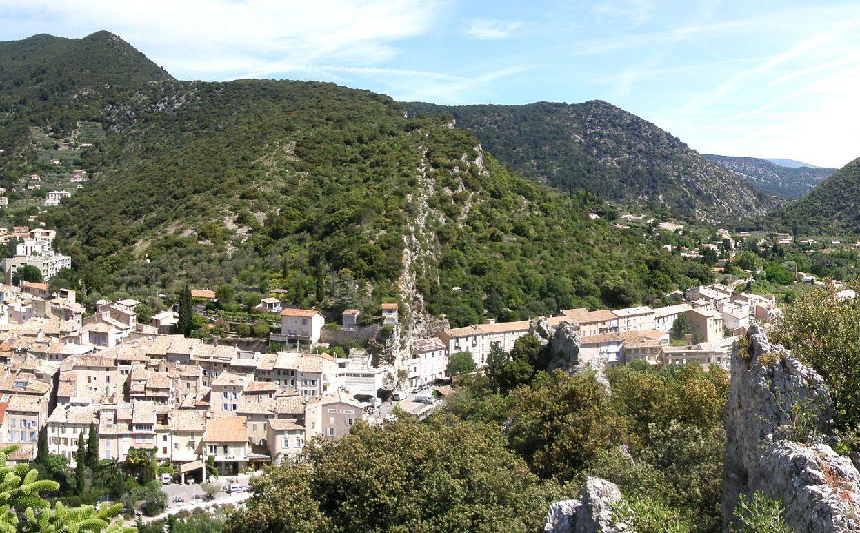
Nyons
The Devès
Easy
2h
3,5km
+260m
-258m
Boucle
Embed this item to access it offline
"It's a ride that I feel the atmosphere" hiking "although being close to the city. After a climb on a small road in the middle of olive trees we reach the Devès hill where we enjoy a view of the whole city of Nyons and the Eygues valley. The trail of Ridge is a little technical in the rocks but such an atmosphere when one leads in the face of the old ramparts of the old-city!!! "Vincent Aubert, sports technician of nature to the RNP Baronnies of Provence.
5 points of interest
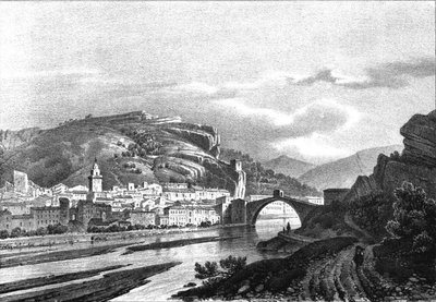
Lithographie de Nyons, au début XIXe - Alexandre DEBELLE  Patrimony and history
Nyons, gateway to the Baronnies
Located between the Vaux Mountain the north and the Eygues banks to the south, contiguous to the clue (rocky around a watercourse), the town of Nyons is the gateway to the Baronnies Provencal massif by the Eygues valley. From the fourteenth to the nineteenth century, its bridge was the only structure, upstream of Orange, to allow the crossing of the river in any season. The city becomes the point of passage for the commercial and military routes.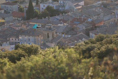
La vieille ville de Nyons depuis le Devès - Pnr Baronnies provençales  Panorama
The city of Nyons from Devès
In the center of the old town of Nyons, the church and the monastery Saint-Césaire are located on a site certainly occupied since antiquity. Above, the Forts district, with its thirteenth-century towers and its walls, is a secular neighbourhood. To the east and west, the city then developed around the Place des Arcades and a street that led to the Alps. The city remained in the walls until the eighteenth and it was not until the twentieth century that it spread in the lowland.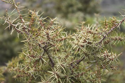
Genévrier oxycèdre - PNR des Baronnies provençales  Flora
FloraThree types of juniper on Devès!
The Devès vegetation, on its slope oriented to the south west very exposed to the sun, is particularly adapted to the hot and dry conditions: it's the scrubland. Several varieties of juniper (G. commun, G. cade, G. of Phenicia) have colonized this stony and filtering soil, where oaks and pines can not plant their roots. Their tiny leaves (thorns) and their small size are all strategies developed to limit their needs (and losses) in water.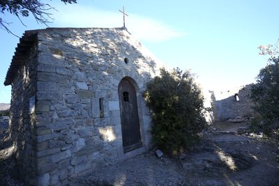
Eglise-Notre-Dame-de-Réparat - Pnr Baronnies provençales  Patrimony and history
The Notre-Dame de Réparat Chapel
The Notre-Dame de Réparat chapel, built at the top of Devès, owes its name to the site that surrounds it, called "la Roche" (rupis in Latin). This district is formerly occupied: its inhabitants took advantage of its belvedere location, between the plain to the west and the Baronnies mountains to the east. Already mentioned in the thirteenth century, it was associated with a hermitage but in the nineteenth century, it is abandoned and falls into ruin. The hermitage was restored about twenty years ago.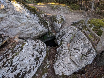
Cavité à côté du Trou du Pontias - Pnr Baronnies provençales  Patrimony and history
The Pontias, the vintage wind
On the city of Nyons and on its heights blows a wind typical of the micro-climate the Pontias. This northern wind is credited with keeping the Nyonsais air fresh and dry. The Pontias legend tells that it appeared when Césaire, bishop of Arles at the beginning of the 6th century, threw his glove against a rock in which he had previously captured a breeze by the sea. Where the glove touched the rock, the earth opened and the wind gushed out, creating the "Pontias hole".
Description
From the car park in front of the town hall, turn left on the street leading to the school. Follow André Escoffier street, which rises to the right of the school. At the dead end, continue on the paved road that climbs 50 meters then continue straight on a stony path that climbs among the olive trees. Cross a path from side to side and continue straight on a narrower path along a wall. Arriving at the concrete road, go up until you reach the big cypresses and turn right along the path that goes up the hedge. The path leads to a paved road that must be followed at the climb. Climb two small bends, then, at the fork at the foot of the big block of ocher rock, turn right on the small road down, which extends to a plank lined with olive trees.
1 - In the left turn, leave the road to take a right on the trail marked by a post indicating the climbing site. Go up this gently sloping path and pass at the foot of the rock climbing. At the exit of the green oak wood (rocky plate), leave the flat path to take the left that climbs. After the stone walls arranged in a circle in the oak grove, climb the wooded scrubland and reach the Devès junction (directional post alt. 470 m) with the GR 9.
2 - Continue the path that goes left on the ridge to the Notre-Dame de Réparat chapel. Pass the Pontias Hole and continue on the Pontias Pass (road).
3 - Make a U-turn and return to the Devès intersection (directional post alt 470 m)
4 - Continue straight to go down the ridge and below, pass rocks and steps. When the path arrives in view of a building, keep going down to the left and, at the first houses, go down the Devès street. Through the small streets of the old town return to the Town Hall Square.
- Departure : Nyons, town hall square
- Arrival : Nyons
- Towns crossed : Nyons
Forecast
Altimetric profile
Information desks
Maison du Parc naturel régional des Baronnies provençales
575 Route de Nyons – La plaine du Pont, 26510 Sahune
Les locaux du Parc naturel régional des Baronnies provençales ne sont pas ouverts au public.
OT Baronnies en Drôme Provençale - Nyons
Place de la Libération, 26110 Nyons
Transport
TER SNCF Coach Connection: Operating hours of the line 71 (Montélimar-Nyons)
Access and parking
51.5 km south-east of Montélimar, by the D 541.
Parking :
Parking de la Place Buffaven (Mairie)
Report a problem or an error
If you have found an error on this page or if you have noticed any problems during your hike, please report them to us here:

