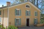
Courchons hamlet
The Courchons hike will take you to the hamlet (altitude 1,350 m), whose school still had 20 students at the beginning of the last century. Today the village is mostly in ruins and pastoralism is the main activity in the sector.
4 points of interest
 Elevage et pastoralisme
This is cow
On the pastures you will often encounter flocks of sheep especially in summer on the pasture lands but you can also meet some of the cattle, the pastures of the Alps of High Provence are suitable to marvel.
 Panorama
Lake view
View of the lake of Castillon. Patrimony and history
The abandoned village
The village of Courchons is located at 1300 meters above sea level and occupies a mountainous plateau overlooking the lake Castillon, offering exceptional views. Only his church has retained a devanture virtually intact: the rest of the houses are largely in ruins. The town was attached to Saint-André-Les-Alpes in 1966.
 Patrimony and history
The bread oven and the Courchons washhouse
For the men who lived here for three or four months a year, as for the people who lived there year-round, water was the first need. The development of a fountain on these heights required many efforts. Water from a spring was collected several hundred meters from here and carried by a canal, or aqueduct, made of dry stone. Around this water point, other developments have gradually gathered: the wash house, the watering trough and the bread oven.
Description
Head towards the N202 road. Turn left and follow it south to Hotel du Lac et forest
1- Take the Courchons track on the right. 500 m, join the intersection with the path of the col des Robines path. Continue to climb by the track. After several turns thus passed, gain the path to the Rouchas house.
2- Leave the Courchons tracks and follow this path passing at the foot of houses. Get in a valley by the path and continue in the undergrowth, in a succession of steep passages and flats to a pass. Go west towards the ridge and the ruins of the Courchons old village.
3- Go past the chapel and continue down to the plateau (leave a track on the right and pass in front of the bread oven. In front of the Granges building, take the track on the right and go up slightly until the oratory. On the other side, go down the path and cut the track several times. At 1 km, leave the path towards Moriez and continue on the track. After two shortcuts, get to the pass.
4- Leave the track and follow the path to the left along a clearing.. Stay on the right side of the field. At the end, go down to another field and go to the right on the edge of the wood until you reach the end. Get down by the track. At 800 m, then join the Subis path. Continue down to the track below.
5- Follow the path below which continues to descend. Pass in front of a horse park, near an old nursery ONF and go out to the road. Take straight, cross the pavilion area and join the village of St-André-les-Alpes.
- Departure : From the Verdun square
- Arrival : On the Verdun square
- Towns crossed : Saint-André-les-Alpes and Moriez
Forecast
Altimetric profile
Recommandations
Information desks
House of the Verdon Regional Nature Park
Domaine de Valx, 04360 Moustiers-Sainte-Marie
House of the Verdon Regional Nature Park
OT Saint André les Alpes - Barrême
Place Marcel Pastorelli, 04170 Saint-André-les-Alpes
Access and parking
Parking :
Report a problem or an error
If you have found an error on this page or if you have noticed any problems during your hike, please report them to us here:


